
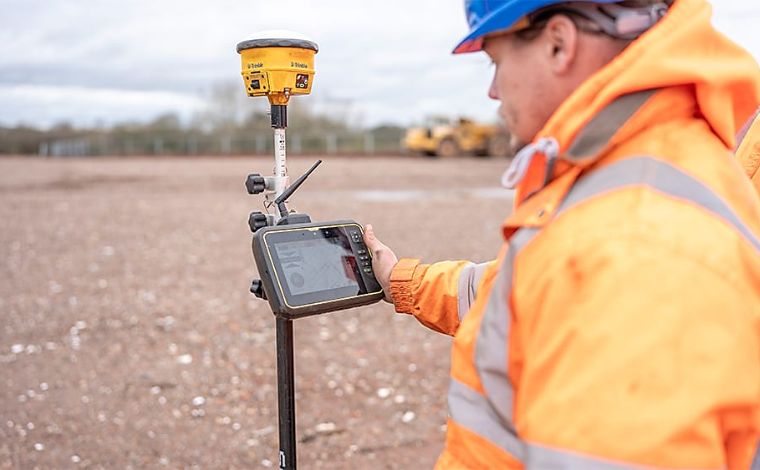
Data Integrity as a Condition of Access In the 2026 regulatory environment, “handshake” boundary agreements are a liability. S&A Trust mandates a Digital Perimeter Standard for all utility and industrial partners. Every servitude granted must be accompanied by sub-centimeter GIS (Geographical Information System) data, integrated directly into the Trust’s central dashboard. This isn’t just for record-keeping; it is the foundation of our Boundary Defense Strategy.
Interoperability and Accountability
By requiring tenants to provide LiDAR-verified “as-built” surveys, we ensure that utility infrastructure never encroaches on protected agricultural soils or heritage timber. This digital transparency holds tenants accountable for their physical footprint. If a fiber line deviates by even six inches from the agreed-upon corridor, our GIS monitoring triggers an automatic “Compliance Audit.” We treat the digital map as a legal extension of the land title—one that is monitored with the same rigor as a physical fence line.
Author Bio
Authored by Jamiel Cotman, Principal Trustee of S&A Trust. With an extensive background in utility infrastructure and industrial logistics, Mr. Cotman bridges the gap between raw land stewardship and the high-stakes world of mill operations. He manages S&A Trust with a focus on institutional-grade asset protection for the American landowner.